Are you relying too heavily on electronics every time you head out on the water? Modern GPS routes have made boating easier and more convenient, but they are not foolproof. Signal interference, outdated charts, weak reception, and onboard power failures can quickly create dangerous navigation situations.
Many boaters discover too late that electronic systems alone cannot guarantee safe passage. Understanding the most common navigation problems and learning how to build robust backup systems can help boaters stay safer, calmer, and better prepared on every trip.
Key Takeaways
- GPS systems can fail because of weather, interference, or outdated data
- Paper charts and backup devices remain important
- Regular software and chart updates improve safety
- Multiple navigation tools reduce emergency risks
- Traditional navigation skills still matter on the water
The Real Reasons GPS Routes Go Wrong on the Water
Signal Interference and Jamming
Storms, military activity, radio interference, and intentional jamming can disrupt GPS signals. Crowded ports and busy waterways often experience greater electronic interference due to heavy marine traffic and communication systems.
For example, boaters near commercial harbors sometimes report sudden position shifts or temporary signal loss. Even short disruptions can affect GPS routes, especially during fog, nighttime travel, or narrow channel navigation.
This is why many captains continue improving their skills through navigation lessons and hands-on boating training.
Outdated Nautical Charts
Waterways constantly change over time. Sandbars shift, channels move, buoys get relocated, and shoals develop after storms or dredging operations.
If electronic charts are outdated, GPS Routes may guide vessels into unsafe areas. Coastal regions and shallow waterways are especially vulnerable because underwater terrain changes frequently.
Regular chart updates help boaters avoid:
- Grounding risks
- Incorrect channel markers
- Unsafe shallow areas
- Temporary navigation hazards
Many instructors who offer private boating lessons teach students to review Notices to Mariners before heading offshore.
Weak Satellite Reception
GPS accuracy depends on strong satellite reception. Heavy storms, cliffs, bridges, dense cloud systems, and onboard electronics can weaken signals.
Partial signal loss may cause:
- Delayed positioning
- Route drifting
- Inaccurate vessel location
- Navigation lag
In narrow waterways, even small errors can become dangerous. Professional operators involved in vessel transport services often use multiple navigation systems because offshore conditions can quickly expose weaknesses in satellite navigation.
Software Glitches and Human Error
Sometimes the issue is not the GPS itself but operator mistakes. Common problems include:
- Incorrect waypoint entries
- Frozen chart plotters
- Wrong route selections
- Zoom confusion on charts
A small coordinate mistake can redirect a vessel far off course. Some boaters also rely too heavily on automatic routing without visually checking the surrounding conditions.
This is why customized boating lessons often include real-world route planning and troubleshooting exercises.
Incorrect Depth and Tide Data
Not all GPS Routes account for changing tides, water depth, or seasonal underwater hazards. A route that is safe during high tide may become dangerous later in the day.
- Potential hazards include:
- Shifting sandbars
- Rapid tidal changes
- Unmarked debris
- Seasonal shoaling
Many grounding accidents happen because boaters trust electronic routes without checking tide tables or local depth conditions.
Power Failures on Board
Dead batteries, water intrusion, and electrical faults can cause navigation systems to shut down instantly. Offshore trips and night boating become especially risky when chart plotters suddenly shut down.
Common causes include:
- Battery drain
- Saltwater corrosion
- Wiring problems
- Charging system failures
Without backup navigation tools, boaters can quickly lose situational awareness.
How Smart Boaters Build Navigation Redundancy
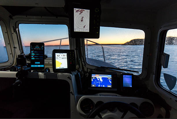
Never Rely on One Navigation Source
Safe boating requires layered redundancy. Boaters should carry:
- Primary chart plotter
- Secondary GPS device
- Smartphone navigation app
- Updated paper charts
Minimum Redundancy Checklist
- Waterproof backup phone
- Portable battery pack
- Paper charts
- Backup charging cables
- Handheld compass
Waterproof storage is important because marine electronics are constantly exposed to moisture.
Learn Traditional Navigation Skills
Even modern boaters should understand:
- Reading paper charts
- Compass bearings
- Dead reckoning
- Visual navigation
Electronics can fail instantly during storms or power outages.
You do not need to become a celestial navigator. You need enough skill to get home safely.
This practical approach is why many experienced captains still take private boating lessons to improve navigation confidence.
Cross-Check Multiple Data Sources
Smart boaters compare information from:
- Depth sounders
- AIS
- Radar
- Weather apps
- Tide tables
- Notices to mariners
If one system shows conflicting information, it may signal a navigation problem early.
Keep Charts and Software Updated
Boaters should regularly:
- Update chart databases
- Install firmware updates
- Review local navigation notices
Updates matter most in shallow coastal regions where waterways change often.
Build a Power Backup Plan
Every boat should carry:
- Portable battery packs
- Secondary battery banks
- Handheld GPS units
- Backup charging cables
Backup electronics should remain inside waterproof containers. Reliable backup power also supports emergency communication systems during navigation failures.
Conclusion
Modern boating technology offers tremendous convenience, but experienced captains know electronics alone cannot guarantee safe navigation. Reliable boating depends on preparation, awareness, and strong backup planning before every trip.
While GPS routes help vessels travel more efficiently, failures can still occur due to storms, signal interference, outdated charts, weak reception, or onboard power issues. Building proper redundancy through paper charts, backup navigation devices, updated software, and practical seamanship skills helps boaters reduce risk, improve decision-making, and stay safer and more confident whenever conditions suddenly change offshore.
FAQs
Why do GPS systems fail on boats?
GPS systems may fail due to signal interference, storms, outdated charts, weak reception, software glitches, or onboard electrical issues.
Are paper charts still necessary today?
Yes. Paper charts remain one of the safest backup navigation options if electronic systems fail unexpectedly.
How often should marine charts be updated?
Boaters should update charts regularly, especially before long trips or navigating shallow coastal waterways.
What is the best backup for GPS navigation?
A combination of paper charts, handheld GPS devices, smartphone apps, and compass navigation provides strong redundancy.
Can weather affect GPS accuracy?
Yes. Heavy storms, dense cloud cover, and severe atmospheric conditions can degrade GPS signal strength and reduce positioning accuracy.