The best drone mapping camera for most US survey and construction work has a 1-inch or larger sensor, a mechanical shutter, and enough resolution to hit your target ground sampling distance (GSD) at a safe flight height. Match the camera to your job, then confirm your processing software supports it.
Already have flight data? Start processing in the cloud with Aeroyantra and skip the GPU workstation.
What a drone mapping camera actually does
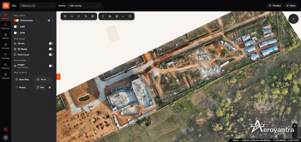
A drone mapping camera captures overlapping images that photogrammetry software turns into orthomosaics, point clouds, and elevation models. The camera does not make the map. It supplies the raw pixels and the position tags that the processing software uses to rebuild the site.
That means a good mapping camera is judged by consistency more than by looks. Sharp images, stable exposure, and reliable GPS tags matter more than a high megapixel number on a spec sheet.
The specs that matter most
Sensor size
A larger sensor collects more light per pixel. That gives cleaner images in overcast conditions, at dawn and dusk, and over dark surfaces like asphalt or wet soil. For paid survey work, a 1-inch sensor is a common starting point. Smaller sensors can work on bright days over open ground.
Shutter type
A mechanical shutter exposes the whole frame at once. A rolling shutter reads the sensor line by line, so fast flight can skew straight edges and hurt the reconstruction. If you use a rolling shutter camera, fly slower and keep the camera pointed straight down.
Resolution and GSD
Resolution lets you fly higher and cover more acres per battery at the same detail. GSD is the ground distance one pixel represents. The formula is:
GSD = (sensor width x flight height) / (focal length x image width in pixels)
Illustrative example, not a specific product: a camera with a 13.2 mm sensor width, an 8.8 mm focal length, and 5,472 pixels across, flown at 200 feet, gives a GSD of about 0.66 inches per pixel. At 400 feet, it roughly doubles to about 1.3 inches. Check your own camera’s specs before planning a job.
Lens quality and distortion
Sharp corners and low distortion help the software match features between images. Fixed lenses with known calibration data are easier to process than cameras with heavy digital correction applied.
Geotagging and RTK or PPK
Every image needs a position tag. RTK and PPK drones record far more precise positions than standard GPS, which can reduce the number of ground control points (GCPs) you place. Many teams still keep a few checkpoints to verify accuracy. For legal or boundary work, rules vary by state, so check requirements with a licensed professional.
Camera types compared
- Integrated 1-inch camera on a compact drone
- Best for: construction progress and small to mid-size sites
- Strengths: low cost, easy to fly, quick setup
- Limits: less coverage per flight than larger sensors
- Integrated camera with RTK module
- Best for: survey and earthwork with fewer GCPs
- Strengths: better absolute positioning
- Limits: higher drone cost, and you still need checkpoints
- Interchangeable full-frame payload
- Best for: large sites, high detail, corridor work
- Strengths: strong image quality and coverage
- Limits: higher cost, heavier aircraft, more setup
- Multispectral camera
- Best for: crop health and agriculture analysis
- Strengths: plant health indices
- Limits: lower resolution, and not a replacement for an RGB mapping camera
How to choose a drone mapping camera by job
Construction and earthwork
Progress monitoring, cut and fill, and stockpile volumes in cubic yards depend on consistent images and a stable surface model. A 1-inch camera with a mechanical shutter handles most sites. Add RTK or plan GCPs for volumes you will bill against.
Mining and stockpile surveys
Large piles and pits mean long flights. Higher resolution and a mechanical shutter help you cover more acres while holding GSD. Shadows inside pits can hurt image quality, so fly at consistent times of day.
Solar site grading and pre-construction surveys
Flat, repetitive ground challenges feature matching. Strong overlap and sharp images make a big difference. Elevation accuracy matters for grading, so plan checkpoints.
Agriculture
Field boundaries, drainage, and elevation work well with a standard RGB camera. Add multispectral only if you need plant health data.
Capture settings that protect your results
Even the best drone mapping camera produces poor maps with bad settings. Use these as starting points and adjust for site conditions.
- Overlap: many crews use roughly 75 percent forward and 65 percent side overlap. Increase it over vegetation or featureless ground.
- Camera angle: straight down (nadir) for most 2D maps and elevation models.
- Exposure: lock exposure and white balance so images match each other.
- Speed: slow down with a rolling shutter.
- Flight height: set it from your target GSD, and stay within FAA rules. Check current Part 107 limits at faa.gov/uas.
- GCPs: spread them across the site, including the edges, and keep checkpoints separate from control points.
- File format: shoot in a format your processing platform accepts, and check its supported list first.
Common mistakes with mapping cameras
- Buying on megapixels alone. Sensor size and lens quality affect results as much as resolution.
- Ignoring shutter type. Rolling shutter distortion shows up as warped edges on buildings and roads.
- Skipping calibration data. Cameras that strip or overwrite metadata can cause processing errors.
- Changing exposure mid-flight. Uneven brightness hurts the final orthomosaic.
- Not checking software support. Confirm your camera is on your platform’s supported list before a paid job.
Processing your drone mapping camera data in the cloud
Once the flight is done, image processing is the next cost. Desktop photogrammetry often needs a powerful GPU workstation. Aeroyantra is a cloud drone-data processing platform, so processing runs on remote servers instead of your own computer.
The basic workflow is short:
- Upload. Add your images and, if you used them, your GCP file.
- Set options. Choose your outputs and coordinate system.
- Process. The job runs in the cloud while you do other work.
- Review. Check the results against your checkpoints.
- Export. Download deliverables for your client.
See what outputs you can generate for the full list. For compatible camera models and drones, see the supported drones and cameras guide.
If you are comparing tools such as Pix4D, DroneDeploy, Agisoft, Propeller, Bentley, or WebODM, test each on your own dataset. Compare cost per acre, turnaround, accuracy, hardware needs, and outputs. Check Aeroyantra’s pricing and review each competitor’s current pricing on their own site.
Who should not choose Aeroyantra
If you need a fully offline desktop workflow with no uploads, a cloud platform is the wrong fit. The same goes if you need a feature that Aeroyantra’s features page does not list. Match the tool to your workflow, not the other way around.
Quick checklist before you fly
- Camera is on your software’s supported list
- Shutter type known and speed adjusted
- GSD target set and flight height calculated in feet
- Overlap set for the terrain
- Exposure and white balance locked
- GCPs and checkpoints placed
- Batteries and memory cards ready
- Airspace and Part 107 requirements checked
Troubleshooting common camera problems
- Blurry orthomosaic: slow down, raise shutter speed, or check focus.
- Warped buildings or roads: likely rolling shutter distortion or a poor camera angle.
- Holes in the point cloud: raise overlap, especially over water, shadows, or uniform ground.
- Elevation errors: add GCPs, check coordinate systems, and verify checkpoints.
- Processing fails to start: check that image metadata is intact and the camera is supported.
Next step
Pick the camera that fits your target GSD and site size, then test it on a real flight. When your data is ready, try cloud processing with Aeroyantra and compare the results to your current workflow.
6. FAQ block
1. What is the best drone mapping camera?
There is no single best option. For most survey and construction work, a camera with a 1-inch or larger sensor, a mechanical shutter, and 20 megapixels or more gives a strong balance of detail and cost. Match the camera to your required ground sampling distance, site size, and budget, then confirm your processing software supports it.
2. Do I need an RTK camera drone for mapping?
Not always. RTK or PPK tags each image with precise positions, which cuts the number of ground control points you need. For projects that need survey-grade accuracy, many teams still place some checkpoints to verify results. Without RTK or PPK, plan on ground control points for any deliverable where absolute accuracy matters.
3. Is a mechanical shutter better than a rolling shutter for mapping?
A mechanical shutter exposes the whole sensor at once, so images stay sharp and geometrically consistent at speed. A rolling shutter reads the sensor line by line, which can distort images when the drone moves fast. You can map with a rolling shutter by flying slower, but a mechanical shutter reduces that risk on larger sites.
4. How many megapixels does a drone mapping camera need?
Megapixels matter less than sensor size and lens quality. Higher resolution lets you fly higher and cover more acres per flight at the same ground sampling distance, but a small sensor with 20 megapixels can still produce noisier images than a larger sensor with fewer. Decide your target GSD first, then pick the camera.
5. Can I use a regular drone camera for mapping?
Yes, many standard drone cameras work well for mapping if they record GPS in each image’s metadata and you fly a proper grid with enough overlap. Use a nadir angle, lock exposure, and avoid heavy compression. Check that your processing platform supports the camera model before you fly a paid job.
6. Do I need a GPU to process drone mapping camera images?
Aeroyantra is a cloud drone-data processing platform, so image processing runs on remote servers instead of your own computer. That means you do not need a GPU workstation to process your mapping flights. Check the supported drones and cameras guide for compatible camera models before you upload your images.